
owner
Gene Garson
My father!
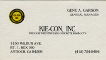
My dad's business card.
General Manager at
Kie-Con, Inc.
A Division of Kiewit Pacific
3551 Wilbur Avenue
Antioch, CA 94509-8530
Telephone: (925) 754-9494
Fax Number: (925) 754-0624
A Precast Prestressed Concrete Products plant. KIE-CON is headquartered in Antioch, California, and is a division of the employee owned Kiewit Pacific Co. My dad opened the plant 1972. A Peter Kiewit Sons', Inc. Company. Link 1 2 3 4 5
http://www.kiewit.com/northern
california/041107
Relatives:
Giziewski, Ethel
www.africabib.org
book/NAMES_INDEX.htm
PART FOUR: INDEX OF TRAVELERS, EXPLORERS AND MISSIONARIES
Giziewski, Ethel 243,602
Giziewski, Ethel. Nigerian Diary. St. Louis, Missouri: Concordia Publishing House. 1964. 31p.
"Dreams Dawn in Africa" - The LWML (Lutheran Women's Missionary League) published a book a few months ago entitled "Dreams Dawn in Africa". It contains the writings of women missionaries who served in the Lutheran Church in Nigeria over the years. Authors include Katie Lautenschlager Fine, Bobbie Lautenschlager, Mary Ottemoeller, Betty Rasch, Wilma Rupprecht, Ruby Bruns, Bernice Bunkowske, Cheri Talsma, Elizabeth Goodine, Peggy Fajen, Ethel Giziewski, Ruth Boettcher, Louise Mueller, Carol Buckman, Helen Konz, Gertrude Bluemel. The book was interesting to me primarily because I happen to know about 95% of the authors. If anyone knows some of the authors and might be interested in reading the book, you can buy it for $6.00 by calling 1-800-252-5965. The order number is 23050. (Submitted by Barb Olson)
http://www.crestrobin.org/
Welcome to the Hillcrest School, Jos, Nigeria website for Alumni Family and Friends. A place to meet with old friends, and rediscover new friends .... to share past experiences and catch up on the present ....
http://www.rootsweb.com/
~usgenweb/sd/sdfiles.htm
South Dakota Gen. Research
• Smothers Brothers 06/27/04
• Smothers Brothers Bio
Esther Viola Smothers
(my grandma)
Haven't totally tracked down the geneaology connection, but my Dad's moms name is Esther Viola Smothers. She had told me that someone from the Smothers Bros. called her about genealogy info but she wasn't interested enough to talk to them about it.
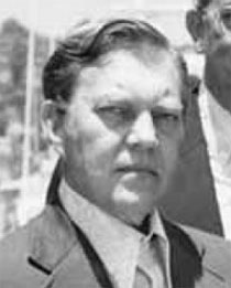
Gene Garson - Secretary-Treasurer of Precast/ Prestressed Concrete Manufacturers of California - San Diego, CA Meeting
Norman Scott Article - Page 5
• jl-04-march-april-7.pdf
• http://www.pci.org
Projects
Antioch Bridge
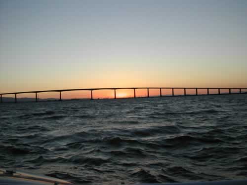
From Angelo Morales of Discovery Bay Sunset over the Antioch Bridge.
abc7news.com Air Date: 10/16/02
http://www.dot.ca.gov/hq/traffops/
systemops/tollbridge/History/
Antioch.html
The $41 million Antioch Bridge (John A. Nejedly Bridge) was opened to traffic in December 1978, and carries over 9,700 vehicles daily.
The high-level structure is 1.6 miles long and 40 feet wide with a narrow shoulder in each direction for bicyclists, pedestrians, and emergency use. It spans the 3,600-foot wide San Joaquin River and extends 4,000 feet onto Sherman Island in Sacramento County to the north and 1,000 feet in Contra Costa County to the south. The bridge has a navigational clearance of 135 feet vertically and 400 feet horizontally.
The American Toll Bridge Company completed the original bridge in 1925 and opened it to traffic in 1926. The company operated the bridge until 1940 when the State acquired it. It is the only northerly highway connection across the San Joaquin River linking east Contra Costa County to the Delta communities of Rio Vista and Lodi. Toll for a 2-axle vehicle is $2, collected from northbound traffic.
http://www.lib.berkeley.edu/
Exhibits/Bridge/antioch.html
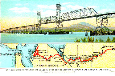
"Through the Netherlands of America." Color postcard of the Antioch Bridge and map from San Francisco to Sacramento, [no date]. Source: Derleth Collection, Water Resources Center Archives.
The original Antioch Bridge was opened in 1926 by Aven Hanford and Oscar Klatt, the owner-builders of the first Carquinez Bridge. Only 21 feet wide and with only two traffic lanes it did not perform very well. Vehicles of more than five tons had to cross at no more than 15 miles per hour, the lift span needed to be raised for passing ships an average of 95 times each month, and the uncomfortably narrow opening led to ship collisions in 1958, 1963 and 1970, that nearly brought down the bridge on each occasion.
In 1976, work began on a new steel bridge that opened in December 1978. The 1.8 mile-long new bridge spans the San Joaquin River between Sherman Island in Sacramento County and Antioch in Contra Costa County. With a vertical clearance of 135 feet, its superstructure is composed of two steel plate girders spanning the piers below and supporting a lightweight concrete slab above. The girders have a protective coating that greatly reduces the need for maintenance or painting.
http://www.mtc.ca.gov/bata/
antioch.htm
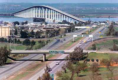
Least-traveled and probably least known of the region's toll bridges, the Antioch also is the only bridge to reach outside the nine-county Bay Area. From Antioch in northeastern Contra Costa County, the bridge arches over the San Joaquin River, touching down in Sacramento County.
Until recently, travel across the Antioch Bridge has remained relatively stable, but growth in the city of Antioch and nearby Contra Costa towns such as Pittsburg and Brentwood is now causing traffic on the Antioch Bridge to increase at a faster rate than on any other of the region's toll bridges.
One of the newest of the toll bridges, the Antioch Bridge is one of only two (the other being the Dumbarton) that were determined by Caltrans to not need seismic retrofit work. The Antioch Bridge also shares another distinction with the Dumbarton - the two are the only state-owned bridges that currently have bicycle and pedestrian access. There are no plans at the present time to widen the Antioch Bridge.
FACTS AT A GLANCE
LOCATION: State Route 160, near Highway 4. between Contra Costa and Sacramento counties
STRUCTURE: Steel plate girder (70 spans)
LENGTH: 1.8 miles
VERTICAL CLEARANCE: 135 feet
CHANNEL SPAN: 460 feet
OPENED:
* Original structure: January 1926 (replaced)
* New Structure: December 1978
COST: * 1926 Structure: $2 million
* 1978 Structure: $34 million
AUTO TOLL: $2
COLLECTION: One way, northbound in Antioch
TRAFFIC LANES: One lane in each direction FY 2001-02
TOTAL TOLL-PAID VEHICLES: 2,325,423 FY 2001-02 AVG. DAILY TRAFFIC:
10,800
TOTAL BASE TOLLS COLLECTED: $3,369,095
THE OLD BRIDGE
The original Antioch Bridge, a two-lane lift span, was the first toll bridge built across a San Francisco Bay tributary.
Opened in 1926, this structure was built by Aven Hanford and Oscar Klatt, the owners of the Carquinez Bridge. They undoubtedly built both crossings to protect their investments against the possible competition of a free bridge.
The old bridge was only 21 feet wide and vehicles over 5 tons could not exceed 15 miles per hour. The lift span was raised an average of 95 times a month for passing ships. Even in the raised position, the opening was too narrow for comfortable passage, especially in dense delta fog. Ship collisions nearly collapsed the bridge in 1958, 1963 and 1970.
A NEW STRUCTURE
In the early 1970s, efforts to build a new bridge paid off. Bids were advertised in May 1976 and construction began on a new structure. A decision was made to use steel rather than concrete spans, cutting the construction time by a year.
The new Antioch Bridge, built by Peter Kiewit Sons' Company, opened in December 1978 at a cost of $34 million. The structure spans the San Joaquin River, extending north to Sherman Island in Sacramento County and south to Contra Costa County at Antioch.
The bridge's superstructure is composed of a pair of steel plate girders which span the piers below, and support a lightweight concrete slab above. The steel girders feature a protective coating which requires little maintenance or painting.
http://www.dot.ca.gov/hq/esc/
tollbridge/index.html?Bridges.html
Antioch Bridge The original Antioch Bridge, a two-lane lift span, was the first toll bridge built across a San Francisco Bay tributary. Opened in 1926, this structure was built by Aven Hanford and Oscar Klatt, the owners of the Carquinez Bridge. They undoubtedly built both crossings to protect their investments against the possible competition of a free bridge. The old bridge was only 21 feet wide and vehicles over 5 tons could not exceed 15 miles per hour. The lift span was raised an average of 95 times a month for passing ships. Even in the raised position, the opening was too narrow for comfortable passage, especially in dense delta fog. Ship collisions nearly collapsed the bridge in 1958, 1963 and 1970. This bridge is not undergoing any current seismic retrofit work nor is there any new construction. This site has no pages dedicated to the Antioch Bridge. The history above was taken from District 4's web site.
http://www.californiadelta.org/
history.htm
By the 1920s, the automobile had arrived. There was a flurry of ferry construction (in one swoop, San Joaquin County installed 18 cable drawn ferries) and bridge-building. Although there had long been ferries in the Delta to take folks on foot or horseback, and horse-drawn wagons and buggies across the waterways, the ferries now also had to be constructed to handle automobiles and trucks. The horse-drawn buggies and wagons were fast being relegated to history.
The Lauritzen brothers established what had to be the most exciting of the ferries when they established ferry service from Antioch to Sherman Island. http://www.lauritzens.com/
who/Whoarewe.asp
Note: Click on their Tower Cam!
After only a few years, their ferry was replaced by the first Antioch Bridge, a giant lift bridge that in its up position could clear the Stockton bound freighters.
http://www.pierfishing.com/pier_of
_the_month/2001-04.html
Fishing at the nearby pier.
http://freespace.virgin.net/john.
cletheroe/usa_can/bridges
Info about all types of bridges.
http://www.rydehotel.com
Local interest
http://www.ci.antioch.ca.us/
CitySvcs/Marina
Antioch Antioch, sits at the juncture of the San Joaquin and Sacramento Rivers. It was founded in 1849 by brothers William and Joseph Smith, and at one time boasted large asparagus canneries. In times past, coal was mined in the hills behind Antioch and brought down to its wharf by locomotives. The first Antioch Bridge to Sherman Island, a tower bridge, was built in 1926. Antioch has plenty of marine activity, marinas, boatyards, several yacht clubs and more. There is a public fishing pier in town and another out near the Antioch Bridge. Marinas in the bridge area include Lauritzen Yacht Harbor, run by third-generation family members, members of the same family that ran boat service around the Delta in the early days, as well as the ferry to Sherman Island. A neighboring marina is Driftwood Yacht Harbor. Antioch has July 4th fireworks, an annual Rivertown Jamboree, and a lighted boat Christmas Parade. Chamber 925/757-1800.
http://boatingonthedelta.com
http://www.cocohistory.com/
photos-antioch.html
Research.
http://www.sacbee.com/content/
news/v-print/story/7510289p-8452313c.html
Carl David Carter, a bridge builder.
He also worked for Brutoco Construction and built the Antioch Bridge with Peter Kiewit Sons Inc.
http://www.pacificnet.net/~faigin/
CA-HWYS/links-regional.html
i707
439-5323
imail@garsondesign
iwww.garsondesign
•• Who
We Are!
•• Awards
•• Community
Service
•• Employment
Ops
•• History
of GDS -
•• Photo Gallery
•• Map
To GDS
•• Personnel
•• • Alumni
•• • DD
Donaldson
•• • Steve
Garson
•• Press/News!
..Updated: Wed 5/30/07 11:06 PM
..Copyright © 2004
Garson Design Services